Report
Investment report
A shareable, AI-graded Terrain Score that proves value and builds buyer trust on the spot.
From the first polygon to a closed deal: draw, analyze, film, publish and follow up without ever leaving Terrain.
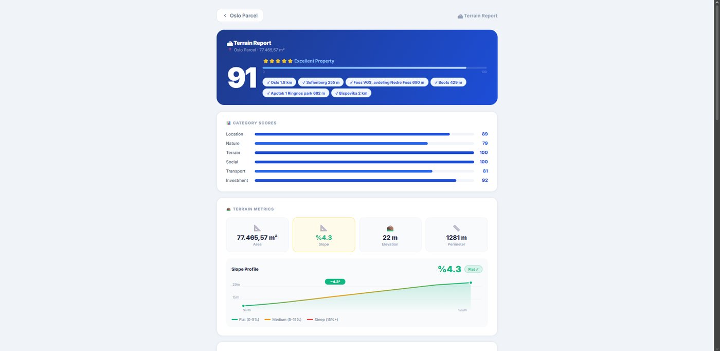
Outline land on a true-3D satellite globe; get area (m²/dönüm), perimeter, elevation & slope instantly. Export PDF, GeoJSON, KML.
A 0–100 investment grade across six dimensions with AI strengths, risks & a star rating buyers trust.
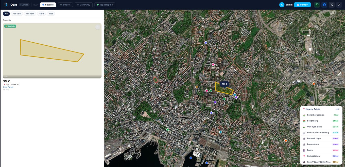
Auto-scan a 5 km radius across 9 categories — roads, water, schools, hospitals, commerce, nature. Add custom points.
Describe the shots; AI sequences a cinematic flyover with TR/EN subtitles & renders a shareable WebM. No drone.
White-label, map-based listings site with your logo & colours. Share by link, QR or embed on your own site.
Sale & rent (daily→yearly), property types, photo galleries, prices in TRY / USD / EUR / GBP.
Capture inquiries into a pipeline with status & private notes; reply by email or WhatsApp in one click.
Track portfolio views, listing clicks & conversion rate with weekly trends — see what's working.
Invite teammates to manage portfolios together, with email invites & in-app notifications.
A shareable, AI-graded Terrain Score that proves value and builds buyer trust on the spot.
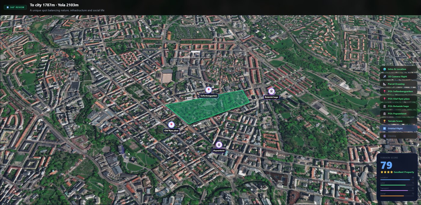
A drone-grade aerial video with data overlays & subtitles — ready for WhatsApp and social.
A live, white-label portfolio page wired to a lead inbox and visit analytics.