Report
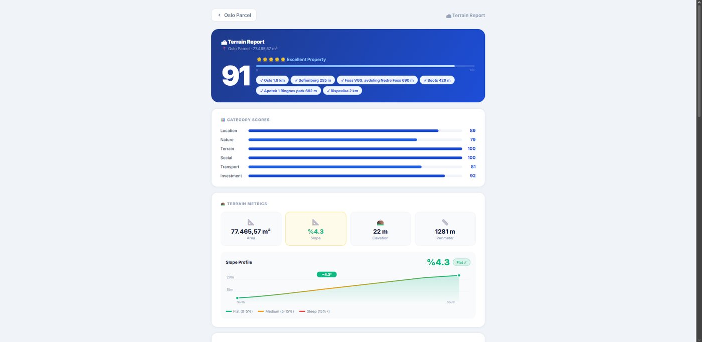
Investment report
A shareable report scored across 6 things — gives clients real confidence on the spot.
No drone, no pilot, no permits. Mark your plot's corners on the map; we build the aerial marketing video, a priced listing page and an investment score. Send the link to your client on WhatsApp.
No credit card · Cancel anytimeYour phone is enough. No drone, no pilot, no video editor.
Tap the corners of your land on the map. Area, slope and elevation appear automatically.
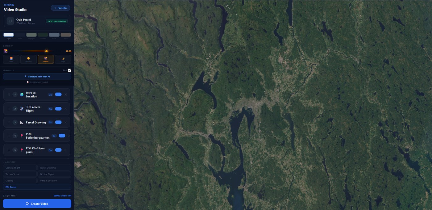
Hit "Generate"; the system builds an aerial marketing video and a priced listing page.
Send the link to your client. Incoming inquiries collect in one panel.
Pick a capability to see it in action.
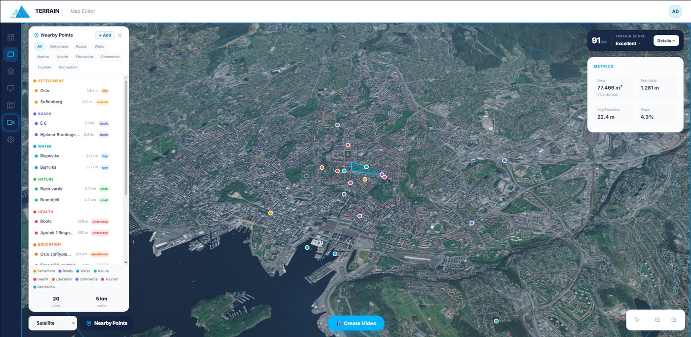
Tap your plot's corners on the map; area, perimeter, slope & elevation appear automatically. Export PDF & map files.
A 0–100 score across 6 things — location, access, slope and more — with strengths and risks. Builds buyer trust.
Describe the shots; the system builds a subtitled aerial marketing video. No drone, no pilot, no permits.
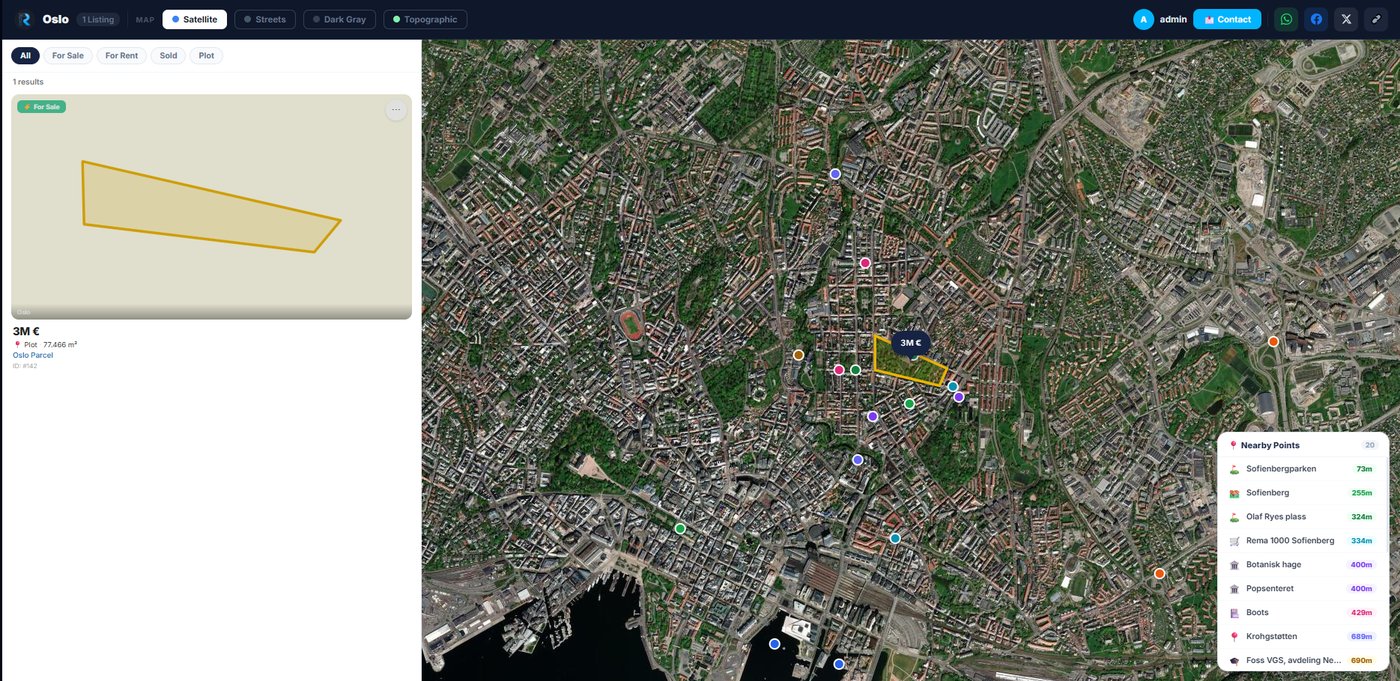
A listing site with your logo & colours. Share by link, QR, or add it to your own website.
Collect every inquiry in one list, reply by email/WhatsApp, and see how many people viewed it.
Here's what you send your client:
A shareable report scored across 6 things — gives clients real confidence on the spot.
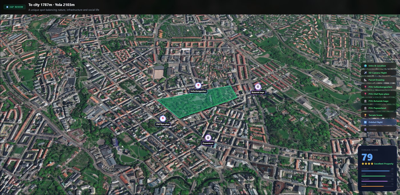
A subtitled, drone-grade aerial marketing video — ready for WhatsApp and social.
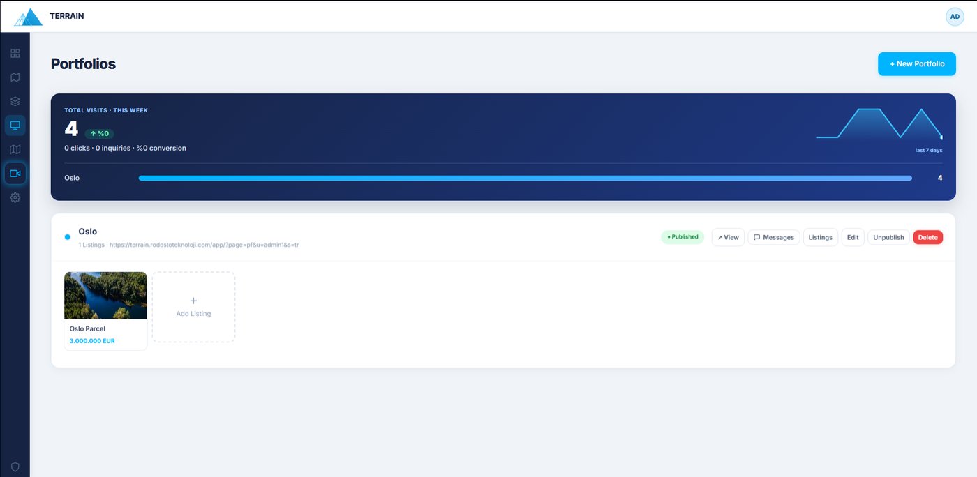
A live listing page with your own logo, a client-inquiry inbox and visit reports.
No card to start. Cancel anytime. No watermark, ever.
A complete platform for real estate professionals: draw land parcels on a 3D map, analyze surroundings, generate cinematic AI flyover videos, publish branded portfolio pages, and manage listings and client inquiries — all in one place.
Yes. Using 3D satellite imagery and real topography data, Terrain creates aerial views of your property — saving up to 90% compared to drone costs, with no pilot, permits or weather delays.
A branded, professional web page that displays your listings on an interactive map. Customizable with your logo, colours and contact info, and embeddable on your own website.
Inquiries from your listing page's contact form are automatically listed in your Inquiries panel. Reply via email or WhatsApp in one click, and track each inquiry from new to closed.
No card needed. For 14 days you use every feature free — draw land, make aerial videos, publish listings. Keep it from 299₺/mo if you love it, pay nothing if you don't. Cancel anytime in one click.
Draw it free today; Terrain turns it into an investment score, an aerial video and a branded listing.
Try free for 14 days →