Report
Investment report
A shareable, AI-graded Terrain Score that proves value and builds buyer trust on the spot.
Draw a parcel on a live 3D satellite globe, score its investment potential, film a cinematic flyover and publish a branded listing — all in one platform built for real estate.
Drag the globe to explore · live ESRI satellite imageryPick a capability to see it in action.
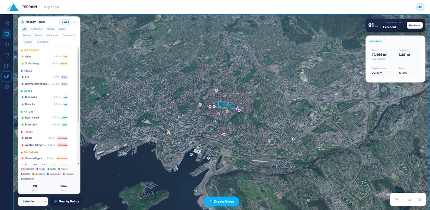
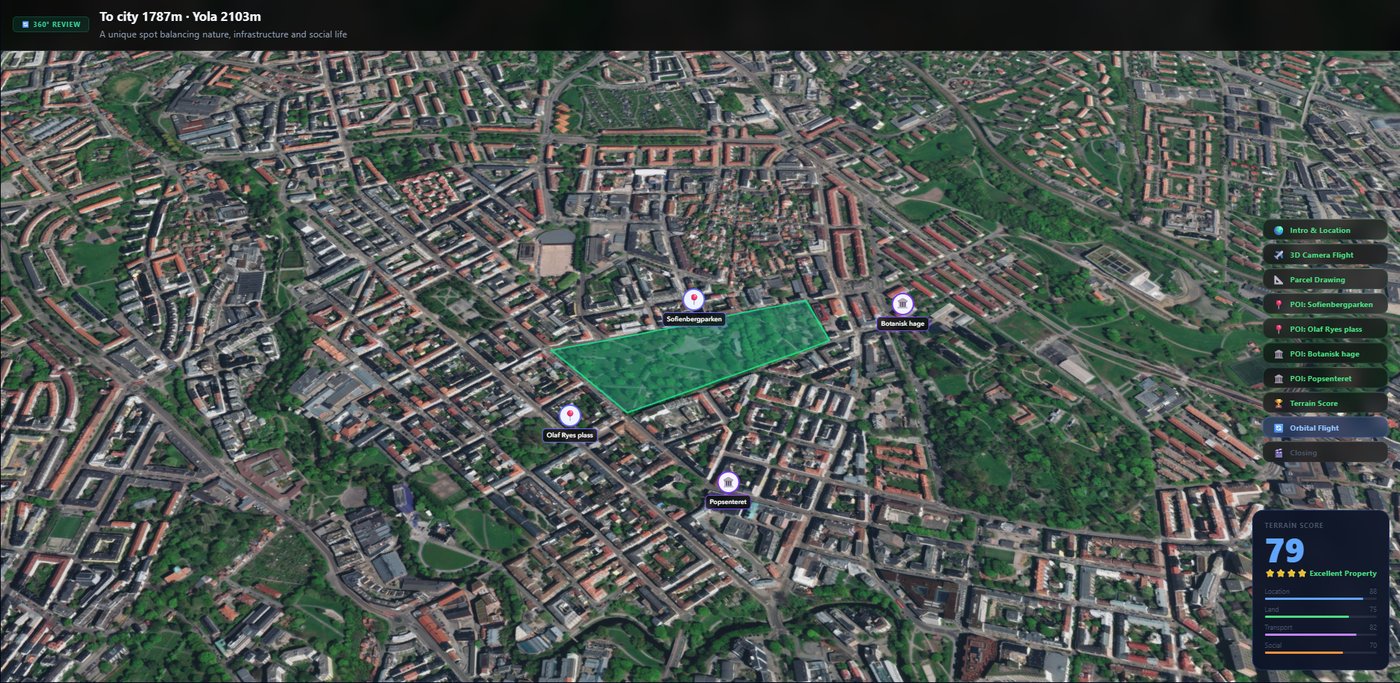
Outline land on a 3D satellite globe; get area, perimeter, slope & elevation instantly. Export PDF, GeoJSON, KML.
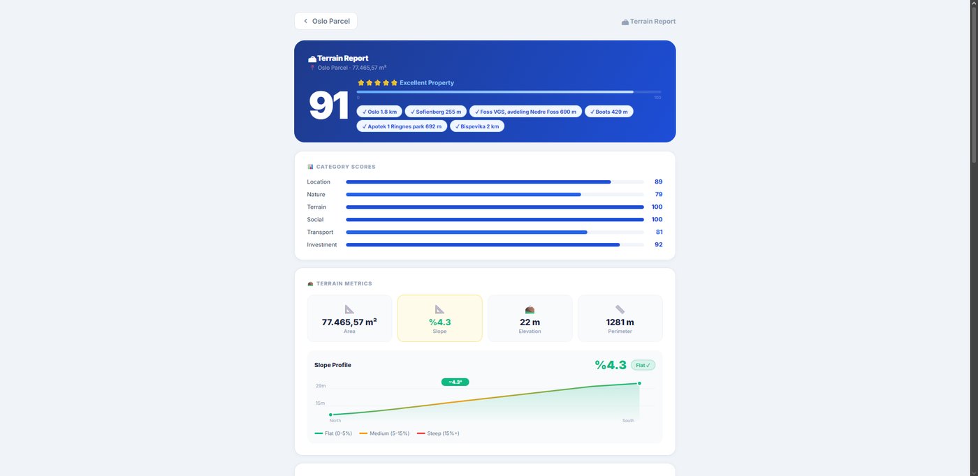
A 0–100 investment grade across six dimensions, with AI strengths, risks and a star rating to win buyer trust.
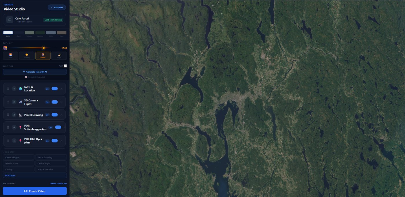
Describe the shots; AI sequences a cinematic flyover with subtitles and renders a shareable WebM — no drone.
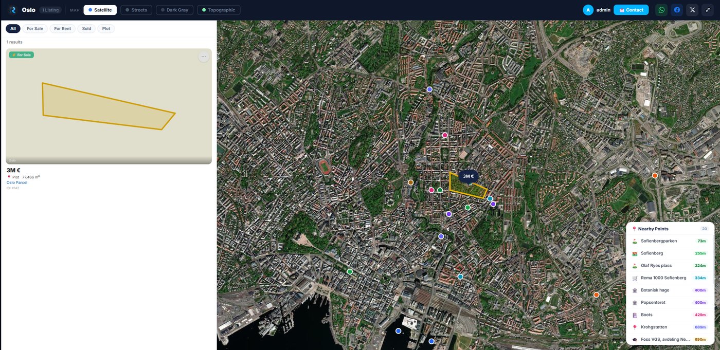
A white-label, map-based listings site with your logo & colours. Share by link, QR or embed.
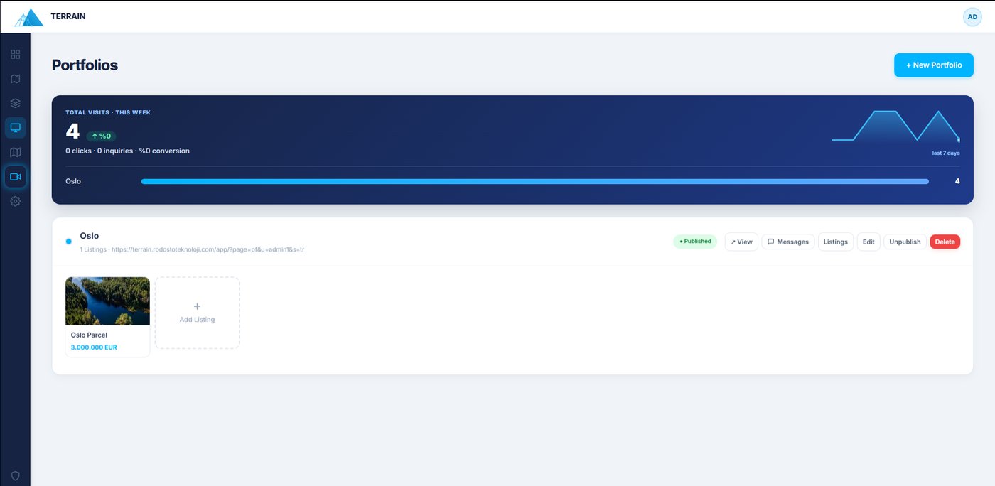
Capture inquiries into a pipeline, reply by email/WhatsApp, and track views, clicks & conversion.
A shareable, AI-graded Terrain Score that proves value and builds buyer trust on the spot.
A drone-grade aerial video with data overlays & subtitles — ready for WhatsApp and social.
A live, white-label portfolio page wired to a lead inbox and visit analytics.
No watermarks on any plan.
A complete platform for real estate professionals: draw land parcels on a 3D map, analyze surroundings, generate cinematic AI flyover videos, publish branded portfolio pages, and manage listings and client inquiries — all in one place.
Yes. Using 3D satellite imagery and real topography data, Terrain creates aerial views of your property — saving up to 90% compared to drone costs, with no pilot, permits or weather delays.
A branded, professional web page that displays your listings on an interactive map. Customizable with your logo, colours and contact info, and embeddable on your own website.
Inquiries from your portfolio page's contact form are automatically listed in your Inquiries panel. Reply via email or WhatsApp in one click, and track each lead from new to closed.
Yes. The Starter plan includes parcel drawings and video credits, plus portfolio, listing management and all core features — with no watermarks.
Draw it free today and watch Terrain turn it into a score, a video and a branded listing.
Create your free account →